Hermine preparation continues, despite sunny skies
TOMS RIVER - Sunday started out sunny but the wind will kick up and some flooding is still a possibility as utilities and the state keep their guards up.
Meteorologist Dan Zarrow said Hermine's track has shifted further to the east which is good news for the Jersey Shore. The shift eastward does mean we can decrease the chance for 3-plus-inch rain bands to almost zero. This was always our biggest “question mark” regarding the Hermine forecast, and we’ve trended far from a worst-case scenario, Zarrow said.
"While some rain may still drift over the Garden State, mainly on Monday, totals will be quite low. The shift has also significantly decreased our cloud cover – Sunday may ultimately stay pretty pleasant, especially the further north and west in New Jersey you go. Such a shift also means we can decrease our wind forecast. Expect winds to increase late Sunday through Monday, sustained at 20 to 30 mph, with gusts to 40 mph inland and 50 mph along the coast," Zarrow said.
The move to the east doesn't mean that preparation stops.
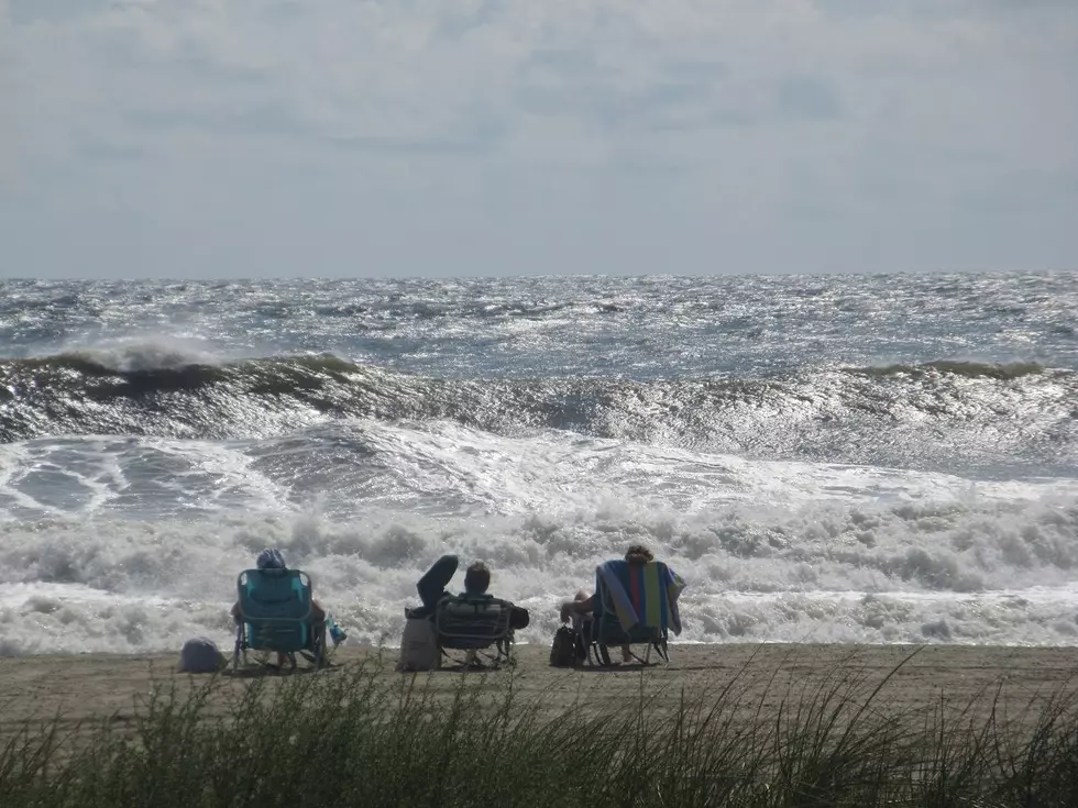
“The sun may be out, but the surf is dangerous, especially for those who are inexperienced with ocean waters and rip currents.. We do not recommend going into the water at this time,” Vince Jones, Atlantic County Emergency Management Coordinator said.
Gov. Chris Christie at a press conference on state preparations warned against being lulled into a false sense of security. "Something's going to happen," Christie said, adding that no one should go in the ocean because of the rip currents.
North Wildwood Mayor Patrick Rosenello said his city removed trash cans and banners off the boardwalk and lifeguard stands off the beach.
"We have everything 100 percent ready to go and we are standing by to see if this thing comes back and causes any flooding. So far we've had nothing significant," said Rosenello.
JCP&L spokesman Ron Morano said 2,400 linemen, hazard responders, public protectors, dispatchers, forestry and other support personnel standing by to assist. Staging areas have been set up at Monmouth Race Track in Oceanport; Six Flags Great Adventure in Jackson; FirstEnergy Park in Lakewood; and the Oyster River nuclear plant in Forked River
“We also have taken aggressive storm preparation steps to help secure our system, including setting up specially designed flood barriers and pumps in several key substations as an added precaution should rising water levels cause any issues with the localized electrical system," Morano said.
Ocean County Office of Emergency Management Paul Daley said the dunes are in the best shape since Sandy and is looking to Monday night's high tide for the worst of the potential flooding the bays and inland.
"It looks calm now but it this is going to hit the way they're saying we could have some major flooding. That's what we're concerned about."
Island Beach State Park is closed Sunday and again on Monday.
Daley was not calling for anyone to leave their homes just yet but advised "you really need to be ready to go if you're in a flood prone area," Daley said.
More From New Jersey 101.5 FM