

Here we go again, NJ: Another rain and wind storm
The Bottom Line
Our weather has been very active lately. And there is no sign things will be quieting down any time soon.
There are several noteworthy weather headlines to highlight:
1.) We squeeze out a reasonably pleasant January day for Thursday. Rivers, streams, and creeks are still running high.
2.) Our next storm system rolls in late Friday night. Heavy rain could cause a reemergence of flash flooding, river flooding, and coastal flooding. Strong winds could once again spark power outages.
3.) A big, blustery cooldown arrives this weekend.
4.) Colder air may set the scene for widespread accumulating snow, from our next next storm system early next week.
Let's dive into the details, so you know what to expect and can plan accordingly.

Thursday
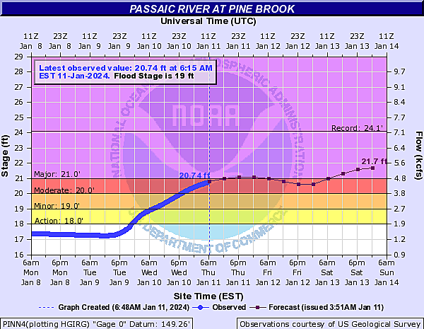
Numerous Flood Warnings remain in effect for rivers, streams, and creeks around New Jersey. Lots of runoff from rainwater and snowmelt is still working through the watersheds. Many waterways are still cresting above moderate to major flood stage. I am especially watching the Passaic River system in North Jersey, which has not quite crested yet.
Make sure you continue to obey any road closures — never attempt to drive, walk, or swim through flooded areas. (It is both dangerous and disgusting.)
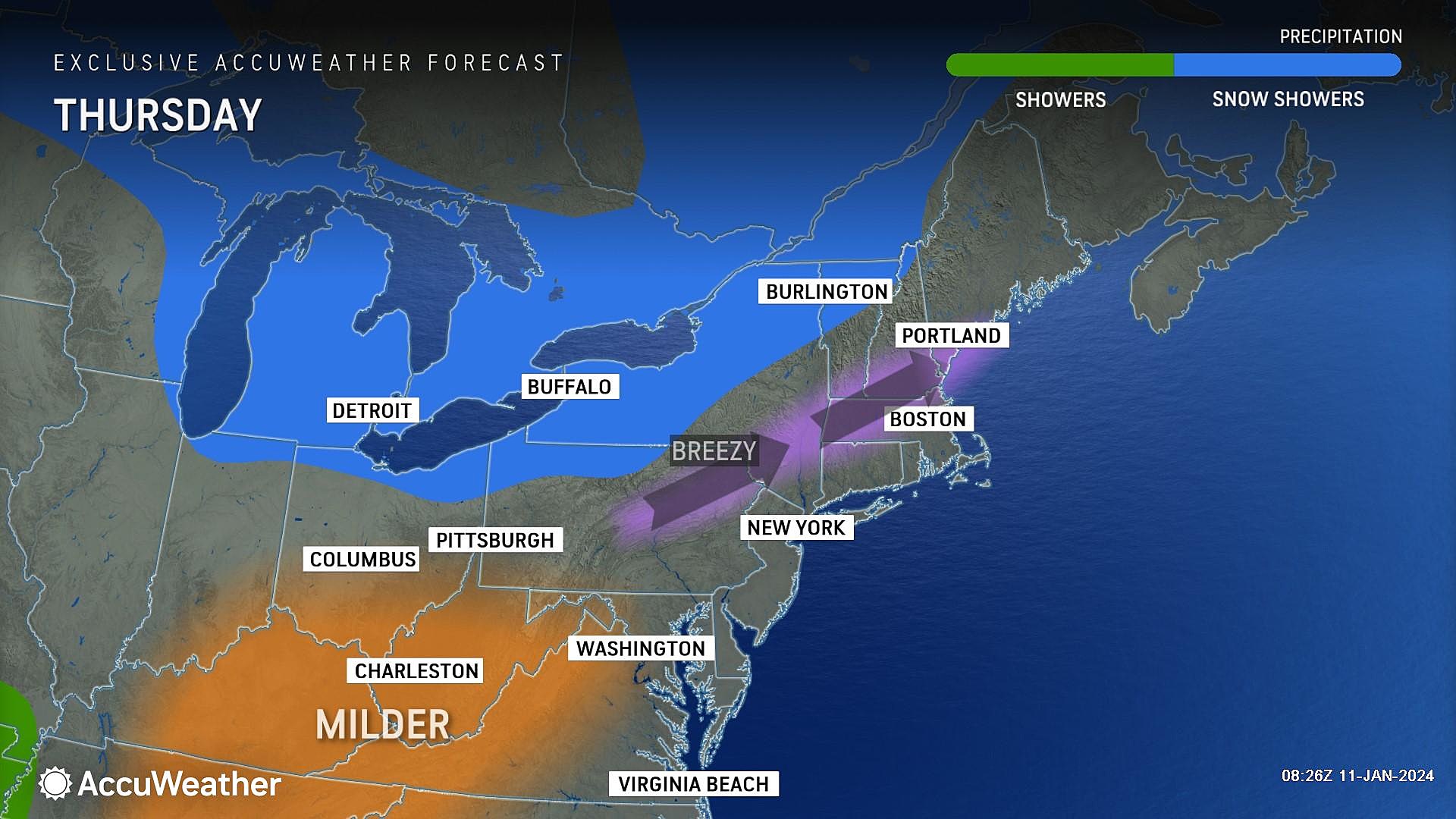
Thursday's weather looks reasonably pleasant, for a mid-January day. Temperatures are starting off above freezing statewide, averaging upper 30s. We will top out around the mid 40s, with mostly sunny skies and dry weather. You will notice a breeze at times, blowing out of the southwest up to 15 mph.
Thursday night stays quiet, with clear skies and low temperatures around the freezing mark, in the lower 30s.
Friday
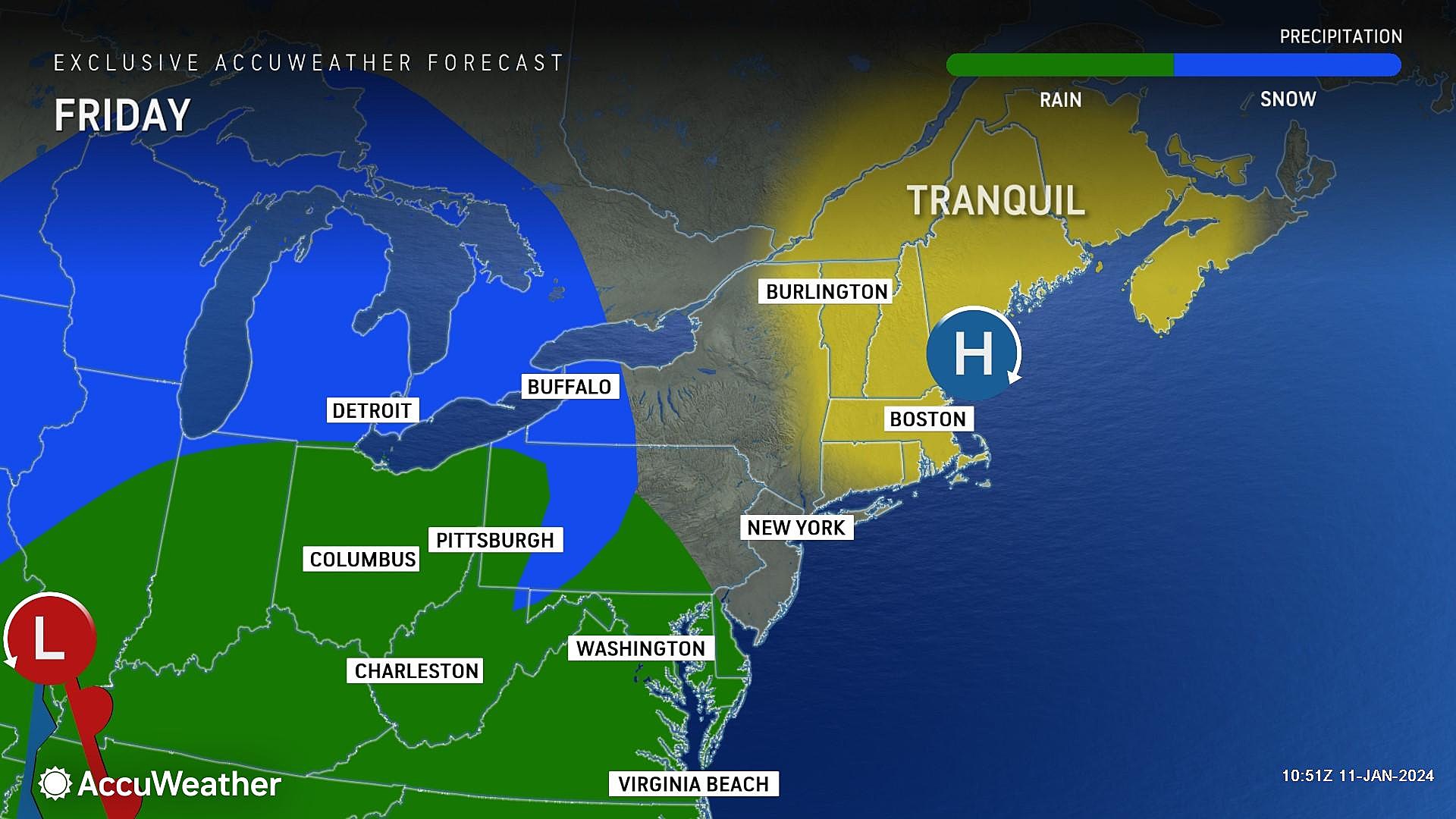
The daytime hours on Friday will be trouble-free. Friday night is a different story.
Skies will progress from sun to clouds throughout Friday. Temperatures will once again shoot for the mid 40s in the afternoon.
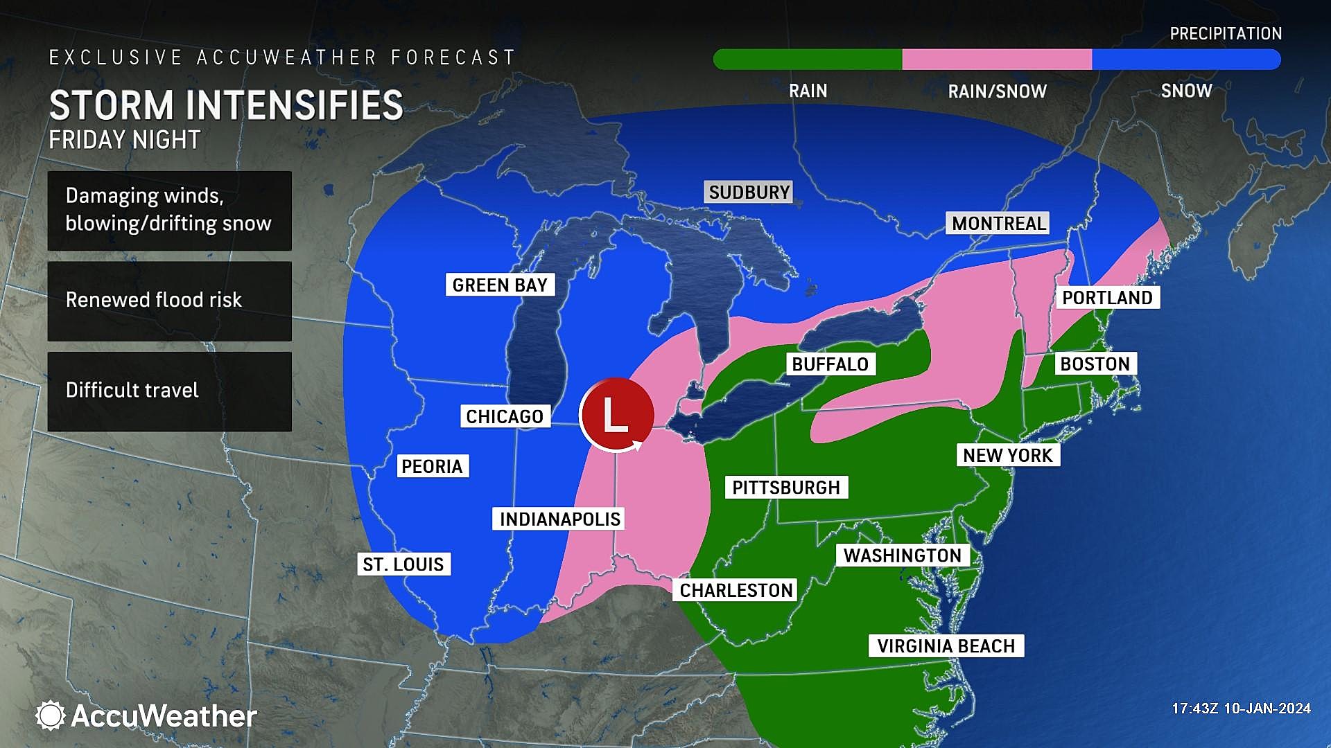
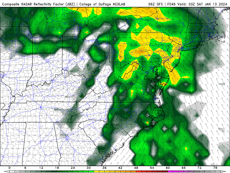
And then our next storm system rolls in Friday night. It will be a compact but potent piece of energy, producing about 10 hours of inclement to nasty weather in New Jersey. It will be a "mini" version of Tuesday's storm — another rain and wind maker.
Here's the timeline for this storm:
—Early Friday evening (around 7 p.m.)... First raindrops will drift into southwestern New Jersey.
—Late Friday night (10 p.m. to 4 a.m.)... The brunt of the storm, with the heaviest rain and strongest winds.
—Saturday morning (by 7 a.m.)... The storm will wind down quickly, as rain exits.
Let's break down the forecast impacts for Friday night and Saturday morning:
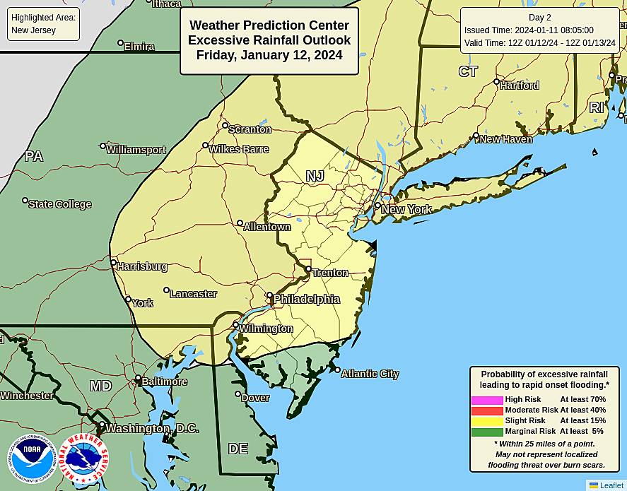
—Rain... About an inch of rain will fall, with the biggest totals in North Jersey. Saturated soil and swollen rivers make a resurgence of flash flooding and river flooding likely. A new crest above Major flood stage is possible along the Passaic River in particular.
—Wind... Top gusts will probably hit 40 to 50 mph. That could bring down branches and trees, and cause another round of power outages.
—Coastal Flooding... Saturday morning's high tide cycle is expected to cause minor to moderate category flooding of tidal waterways along the Jersey Shore.
—Snow... Nope. Maybe a quick hint of wintry mix at onset in far northern New Jersey. But once again, temperatures will surge into the 50s during the course of the storm.
The bottom line: Even though by-the-numbers impacts (both rainfall totals and top wind gusts) will be less severe, this storm will still be quite impactful across the entire state. It is definitely fortuitous that most New Jerseyans will be safe and sound in bed as the storm blows through, rather than out-and-about on the roads.
Saturday
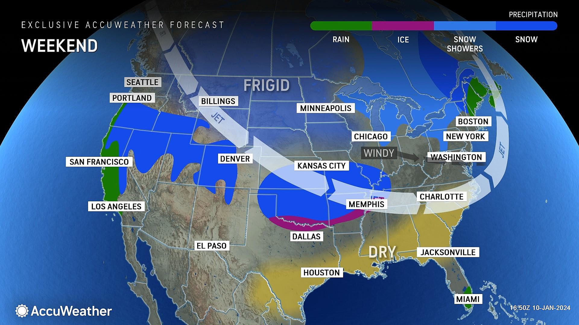
After the storm wraps up in the early morning hours, skies will quickly clear to sunshine. And then our attention turns to a cold air mass that will take over most of the United States this weekend.
For New Jersey, temperatures will tumble from the mid-upper 50s in the morning, to about 40 degrees by sunset. The cooldown will be driven by a brisk west-northwest wind, gusting to 40 mph. With such a strong wind and sharp cooldown, I think it's fair to call this transition an "arctic blast".
By Saturday night, we will drop below freezing. In fact, starting Saturday night, North Jersey could be stuck at or below the freezing mark for 10 straight days. Welcome to the dead of winter, folks.
Sunday
A reinforcing shot of even colder, even drier air will push in Sunday.
Sunday will be bright and sunny. But still blustery, with wind gusts around 30 mph. High temperatures on Sunday afternoon will only reach the mid 30s — squarely below normal for mid January.
Monday & Beyond
Our next next storm system in this active period of weather is expected to sweep past New Jersey early next week.
With highs only in the 30s on Monday and Tuesday, it will definitely be cold enough for an "all snow" situation.
However, the storm's path is still highly uncertain. With the influx of cold air, the dominant storm track (the "highway in the sky," if you will) gets shoved to the south.
So we could get hit by a moderate snow event, spreading "a few inches" of shovelable accumulation across New Jersey around Tuesday next week.
But there is an equal chance of barely getting swiped, only enough for some snow showers and single inch of fluffy snow at most.
So there are more questions than answers surrounding the forecast for early next week. And I am really not worried about it, with Friday night's stormy weather and this weekend cooldown taking top priority at the moment. Once we get into the weekend, I fully expect to have a clearer, more confident view of what's coming down the pike next week. As always, stay tuned.
NJ DOT humorous safety messages 2.0
Gallery Credit: Dan Alexander
Dan Zarrow is Chief Meteorologist for Townsquare Media New Jersey. Follow him on Facebook for the latest forecast and realtime weather updates.
Restaurants that closed in New Jersey During 2023
Gallery Credit: Dan Alexander
More From New Jersey 101.5 FM


