A bit more ‘blah’ weather for NJ: Clouds, sprinkles, and flurries
The Bottom Line
Our weather has definitely quieted down. And we need a dry stretch of weather, after such a soggy January. (It will probably rank in the top 5 or top 10 wettest Januarys on record for NJ.)
The next two weeks look mainly dry. Having said that, there will be a few hiccups and shower chances along the way.
While Tuesday probably stays dry, dreary conditions return on Wednesday with some sprinkles and flurries around.
Thursday will be the warmest and nicest day of the week. Friday morning will bring rain showers. Then the first weekend of February looks bright and sunny, although also seasonably chilly.

Tuesday
Temperatures are not going to budge much from Tuesday morning to Tuesday afternoon. We will climb from the lower 30s to upper 30s. That is close to the normal high temperature for late January.
I am hopeful New Jersey catches some peeks of sunshine through the morning hours, before clouds thicken up again in the afternoon. Winds will be lighter than Monday, which is good news. And our weather should stay dry.
Tuesday night will be quiet and cool. Mostly cloudy and lower 30s.
Wednesday
It is only fitting that this soggy month ends with a few more raindrops (and snowflakes) on Wednesday.
It is going to be yet another "blah" weather day overall, as a clipper system passes south of New Jersey. Expect cloudy skies from start to finish. And a few sprinkles to the south and a few flurries to the north. That rain/snow is so non-impactful, I have left the rain/snow icon off my 5 Day Forecast.
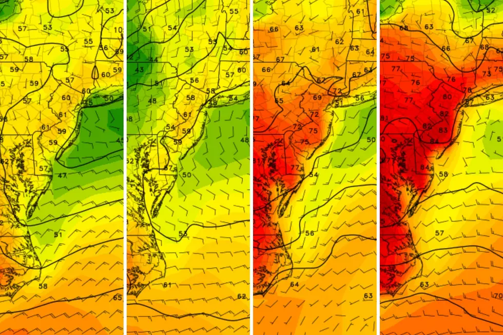
High temperatures on Wednesday are forecast to reach the lower 40s.
Thursday
On Thursday, our weather turns around nicely. It should be a pleasant way to kick off February.
Under partly sunny skies, high temperatures should reach the upper 40s to around 50 degrees. That is firmly above normal for this time of year. Hey, I'll even call it mild. (Not exactly "warm" though — you'll still need a jacket all day.)
Dry weather, bright sky, light breeze. Nothing to complain about here.
Friday
Our next minor storm system arrives Friday morning. Expect a quick wave of showers dampening the state to begin Groundhog Day.
The rest of Friday is actually trending better. We'll see periods of sun and clouds, with a stiff breeze. High temperatures will only scale back slightly, to the mid 40s.
The Extended Forecast
If you are in need of some bright, sunny days to brighten up your soul, you will have to wait until this weekend.
As the wind dies down early Saturday, we will be left with sunny skies and a seasonably cool air mass. Highs will reach about 40 degrees — par for the course for early February.
Sunday may be a degree or two warmer, in the lower 40s. But effectively, it is the same forecast with chilly sunshine all around.
Long-range models show a tranquil, cool weather pattern throughout next week. Maybe a late-week cold front to watch for rain/snow and then an arctic blast. But until then, we get a nice reset from the constantly active, stormy weather pattern we have been under since November.
LOOK: Counties with the highest unemployment in New Jersey
Gallery Credit: Stacker
Dan Zarrow is Chief Meteorologist for Townsquare Media New Jersey. Follow him on Facebook for the latest forecast and realtime weather updates.
More From New Jersey 101.5 FM


