

24 hours of damp and dreary weather on the way for NJ
The Bottom Line
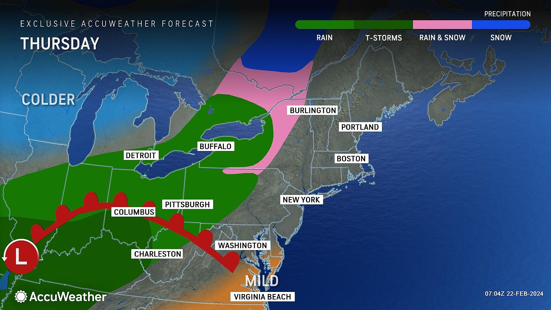
Over the next 48 hours, New Jersey will transition from 1.) clouds, to 2.) rain, to 3.) a cold wind. Even so, there is nothing sensational in the forecast. Just some damp and dreary weather. And a very limited chance of wintry conditions.
The ensuing blustery cooldown this weekend will only be temporary. Temperatures will warm up again next week, into the springlike 60s. But I believe weather conditions will stay unsettled, with a daily chance of clouds and showers through the final days of February.

Thursday
As of Thursday morning, rain is racing across western Pennsylvania. It is still several hours away, but wet weather will start to overtake New Jersey by sunset.
For now, we are starting the day with freezing cold temperatures in the 20s. Highs Thursday should reach the mid 40s — right on the normal for this time of year. The first half of the day will feature nice breaks of sun, and then clouds will thicken up thoroughly through the afternoon.
I would estimate the first raindrops of the day will cross the Delaware River into New Jersey around 3 p.m. So shower chances go up from late afternoon through the evening hours.
Those showers will be spotty to scattered through Thursday evening. Not a constant rain, and I do not think the intensity will be all that heavy.
For the most part, we are talking about just plain rain. But there will be a window of a few hours Thursday evening when snowflakes and/or freezing drizzle could make for some slippery spots. That would only be in far northern New Jersey, north of I-80. And I am not worried about widespread travel impacts or accumulations. (There are some forecast models that even show plain rain all the way to the top of the state.)
Overnight low temperatures will dip into the upper 30s for most, with thermometers slowly rising into Friday morning.
Friday
Overall, it will be a damp and dreary day.
Having said that, latest model guidance has dried out much of Friday. At the very least, it is definitely not going to rain all day. And the chance for a period of steady rain has decreased.
So it is not a total washout. But again, damp and dreary are the operative words. Total rainfall will probably reach a quarter-inch to maybe half-inch across New Jersey.
At least high temperatures on Friday will be on the mild side, close to 50 degrees.
By late afternoon or early evening, we will see an end to the raindrops and skies will start to clear. It will turn breezy late-day, as a north-northwest breeze starts to carry in colder, drier air.
Saturday
Just plain blustery. A renewed chill and a stiff breeze will make Saturday the coldest day of the week.
Expect 20s in the morning, and only upper 30s in the afternoon. We will see decreasing clouds and increasing sunshine. But that northwest wind gusting over 20 mph will add a big bite to the cold air.
Sunday
Sunday will be the calmer day of the weekend, although still chilly.
We should fall into perfect "radiational cooling" conditions Sunday morning, allowing temperatures to plunge deep into the teens and 20s.
Winds on Sunday will be much lighter than on Saturday. And we will see sunshine from start to finish.
However, high temperatures will only reach about 40 degrees. Stuck on the cold side of normal for one more day.
The Extended Forecast
A big warmup is forecast for next week, pushing into the 50s for Monday and Tuesday. And then the 60s for Wednesday and Thursday.
But it won't be perfectly warm weather, as it will be accompanied by clouds and a few pockets of rain. Unsettled is a good word for it. But if we can catch some rays of sunshine, pushing temperatures toward 70? Oh boy, everybody is going to hit the walking trails, boardwalks, and golf courses for an afternoon.
A cold front will knock back temperatures again around Thursday or Friday of next week week, with some rain and snow too. And then it looks like pleasant, mild weather will return through the first third of March.
Dan Zarrow is Chief Meteorologist for Townsquare Media New Jersey. Follow him on Facebook for the latest forecast and realtime weather updates.
15 Camden Waterfront Concerts to Look Forward to in 2024
Gallery Credit: Heather DeLuca
More From New Jersey 101.5 FM


