‘Rain train’ shifts – a few showers, pops of sun for NJ Tuesday
Sick of the rain yet? North Jersey was the wettest spot in the state on Monday, with top rainfall totals over 2 inches around Sussex County. Southern New Jersey was much drier, but still had to endure isolated showers and sprinkles and tropical humidity. We have two more days of unsettled, super-humid air to deal with, before a pattern change helps us dry out for the late part of the week.
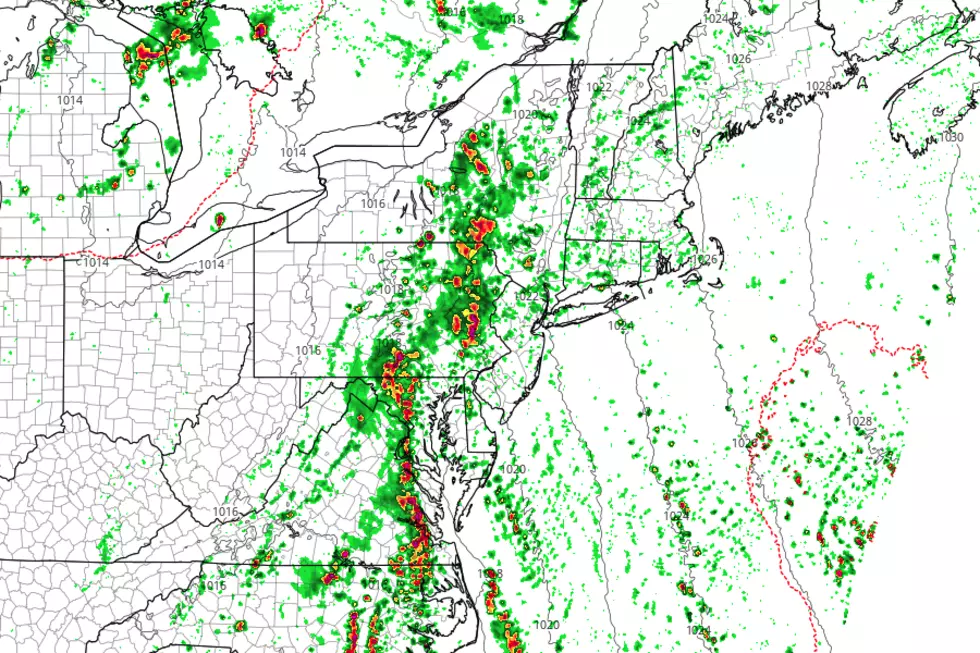
As of this writing (6 a.m. Tuesday), the radar is pretty quiet. There are a few batches of showers in northern and western New Jersey Tuesday morning, along with several very isolated bits of rain throughout the rest of the state. As expected, the active storm track has nudged west by about 50 miles. That means Pennsylvania will get soaked again Tuesday, while New Jersey stays drier.
While I have to keep hit-or-miss showers in the forecast Tuesday, I think it's going to be a "mostly dry" day for New Jersey. In fact, breaks of sunshine are a definite possibility along the coast Tuesday afternoon! Look for high humidity, with high temperatures between about 80 and 85 degrees. A high risk for rip currents and rough surf continues along the Jersey Shore, for the 4th day in a row.
Occasional showers are possible for Tuesday night as well, and we'll stay very humid. Lows will only fall into the lower to mid 70s — not very comfortable at all.
On Wednesday, that storm track pushes eastward again. As it does, we'll experience the wettest day of the week. Showers and thunderstorms are pretty much guaranteed throughout Wednesday morning, afternoon, and evening. A period of steadier, heavier rain is possible too, which could make part of the day a washout. (We'll also have to be on the lookout for potential flooding issues.) Amidst the raindrops, Wednesday will be very humid and breezy, with high temps held at bay in the mid to upper 70s.
Our pattern change comes on Thursday, with a break of drier weather finally taking over. An isolated shower is still possible Thursday morning, before skies become partly sunny Thursday afternoon. Thermometers will cook, and humidity will drop only slightly. High temps are forecast to end up between 85 and 90 degrees on Thursday.
Friday will start off hot and humid, with highs again near 90 degrees. Eventually, a cold front will deliver a brief dose of rain to the Garden State. Right now, I'm thinking Friday afternoon through early Saturday morning is the best chance for showers and thunderstorms.
I remain optimistic that most of the weekend will be dry and (dare I say) pleasant! After showers wrap-up Saturday morning, we'll see partly to mostly cloudy skies for the rest of the day. It will be slightly less humid and a bit cooler, with seasonable high temperatures in the mid to upper 80s.
It looks like Sunday will bring more clouds than sun, with high temperatures holding steady in the mid to upper 80s.
Our next storm system is currently forecast to arrive Sunday evening. This one is also expected to get "stuck" over New Jersey, posing a threat for daily scattered showers and thunderstorms once again. I believe we will see more "stormy" than "completely dry" days through the first few days of August — but there will be pops of pleasant weather along the way.
More From New Jersey 101.5 FM


