CONFIRMED: A tornado hit New Jersey and damaged high school
STANHOPE — The National Weather Service has declared that damage from a storm on Tuesday night was caused by a tornado.
UPDATE, 1:30 p.m. Wednesday: A tornado watch is now in effect for Wednesday until 8 p.m. in Atlantic, Burlington, Camden, Cape May, Cumberland, Gloucester, Mercer, Salem and Hunterdon counties.
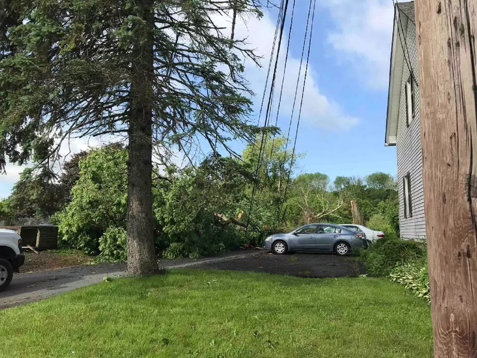
The storm roared through Sussex County around 8:30 p.m. and brought down trees and wires, especially in the Stanhope, Hopatcong and Netcong area. Lenape Valley Regional High School in Stanhope took heavy damage, with three utility poles knocked over, according to JCP&L spokesman David Newcomb.
"There was damage to the portico, the home softball dugout was turned upside down about 20 feet from where it stood, some roof pieces were torn and massive trees were uprooted. A light pole in the faculty parking lot is bent and lots of wires came down," superintendent Paul Dirupo told New Jersey 101.5.
Dirupo said a determination about classes on Thursday will be made later in the day on Wednesday. School was closed on Wednesday because of the damage.
The National Weather Service determined the tornado was an EF1 on the Enhanced Fujita Scale with winds of 86-110 mph. The survey team's investigation would continue on Wednesday afternoon to determine the tornado path's length and width.
New Jersey 101.5 chief meteorologist Dan Zarrow said he was not surprised at the conclusion of the survey team given the strong rotation signature he saw on radar.
"While tornadoes are rare in New Jersey, they do happen — and the damage in Sussex County illustrates why we all need to take severe weather threats very seriously," Zarrow said.
Zarrow said that storm surveys are complicated, but the process is grounded in science and engineering.
He said once the pattern of damage was found to be caused by rotational winds, the team uses "damage indicators" to classify the storm on the Enhanced Fujita Scale.
"Storm surveyors will examine the type of damage, the type of construction, the size of trees that were blown down, etc. to estimate the wind speed," Zarrow said.
Finally, using GPS and GIS techniques, the team will calculate the path width and length of the tornado.
Zarrow said a waterspout was reported in Fortescue along the Delaware River but a survey team will not be sent.
Severe storms are likely again Wednesday, Zarrow reports.
Contact reporter Dan Alexander at Dan.Alexander@townsquaremedia.com or via Twitter @DanAlexanderNJ
More from New Jersey 101.5
More From New Jersey 101.5 FM