Warm summertime weather for NJ for the first half of the weekend
As for the second half of the weekend? Not nearly as warm and summerlike.
The last weekend of April is upon us, and our warming trend is set to peak with some downright summery temperatures for both Friday and Saturday. It seems quite appropriate that unseasonable warmth is no the way, as we prepare to wrap-up one of New Jersey's warmest Aprils in recorded history. But we won't enjoy the heat through the entire weekend — Sunday is going to bring very different weather to the Garden State.
Here are your weather headlines for Friday, April 28, 2017...
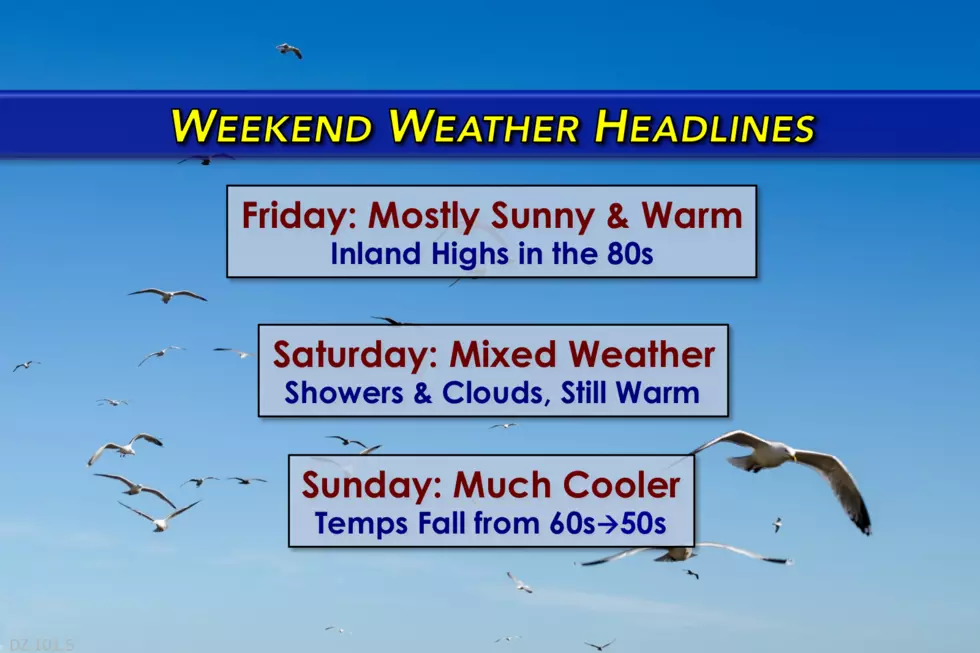
Friday: Sunny and Warm
Early Friday morning, a weak front fired off a line of showers and even thunderstorms. As of this writing, the few remaining showers are pushing off the Jersey Shore. And then we should see rapidly clearing skies, with glorious golden sunshine by about mid-morning. Most high temperatures will soar into the lower to mid 80s by Friday afternoon.
However, just like on Thursday, I'm concerned that the combination of clouds, fog, and sea breeze will keep the Jersey Shore considerably cooler once again. I'll optimistically call for 70+ degrees along the coast. But 60s are possible too, especially on the barrier islands that are surrounded by chilly ocean/bay water.
All around, Friday will be a pleasant day, followed by a beautiful evening. Friday night will be quiet too, with increasing clouds. Temperatures really won't be that cool, only dropping into the lower to mid 60s by Saturday morning.
Saturday: Mixed Weather News
Let me start by reaffirming the fact that Saturday is going to be another unseasonably warm, summerlike day for the Garden State. Even along the coast! But there will be some raindrops and clouds along the way.
North Jersey will get clipped by a storm system Saturday morning, say from about 4 a.m. through Noon. I expect most of the rain activity to be showery, but there could be some pockets of steadier stuff at some point.
Where it really rains and where clouds remain on Saturday? Highs in the 70s. Otherwise? Lower to mid 80s. Southwest New Jersey (near the Philadelphia metro area) could surpass 87 degrees — that's practically hot!
Sunday: Much Cooler
A backdoor cold front. A funny name perhaps, but it's a weather phenomenon with very noticeable impacts for New Jersey.
We call it a "backdoor" front because it comes from the "wrong" direction. You see, usually our prevailing winds from the west also push in storm systems from the west. However, in this case, a switch to easterly winds will shove cool, fairly humid air over New Jersey. That will lead to overcast skies, an isolated shower chance, and a chilly wind.
Thermometers on Sunday will tumble from the 60s in the morning to the 50s by the afternoon. A very, very different weather picture than Saturday's near 90 degree temperatures.
Monday: Back to the Warm Side
The aforementioned backdoor cold front retreats as a warm front by Monday, so we'll warm up again. With highs in the 70s, it should be a decent, above normal day.
Our next weather maker still looks likely for the Monday night-Tuesday morning time frame. This strong cold front will probably spawn a line of strong thunderstorms across New Jersey during those overnight hours.
Behind the front, we'll turn cooler. The temperature forecast for Tuesday and beyond, however, remains pretty low confidence at this time. I'm probably leaning toward a near-normal forecast. But I wouldn't rule out a couple of cooler days, especially if that chilly ocean water comes into play yet again.
Have yourself a wonderful weekend! See you back here dark n' early Monday morning!
More From New Jersey 101.5 FM


