

Two more cold fronts for 2016: Rain Tuesday, some snow Thursday
The Garden State's weather forecast through New Year's Eve includes a mixed bag rain, snow, sun, warmth, cold, and wind.
Here are your weather headlines for Tuesday, December 27, 2016...
Warm and (Somewhat) Wet Tuesday
You might be surprised as you step out the front door on this Tuesday morning, to find some very warm temperatures have taken hold across most of New Jersey. We've been close to 60 degrees all morning in South Jersey, with cooler upper 40s in North Jersey. This kind of warm, fairly humid air mass is quite unusual for late December. In fact, statewide morning temps are above the daily normal high temperatures for this time of year.
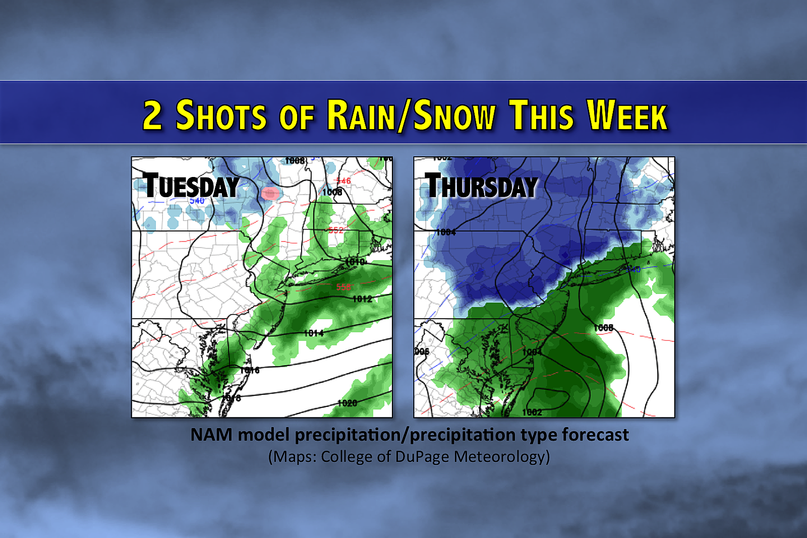
Meanwhile, a cold front is moving toward New Jersey, with an area of low pressure (and heavier rain) riding northward along the front. If the low and the front pass over New Jersey at the same time, at least part of the state will experience a period of steady rain by late morning through early afternoon (done by about 1 p.m.)
Following frontal passage, skies should begin to clear and temperatures will begin to drop (starting around 3 p.m.) A stiff breeze will accompany Tuesday, potentially gusting to 30 mph.
Clearing
As I already mentioned, skies will begin to clear by late afternoon - a trend that will continue overnight. That, along with lightening winds, will allow temperatures to dip into the "chilly zone," bottoming out in the upper 20s in North Jersey to the lower 30s through the rest of the state.
Temperatures on Wednesday will be typical for late December, with forecast highs between about 40 and 45 degrees. The day will start sunny, with increasing clouds by Wednesday afternoon.
Thursday Could Get Messy
Our final storm system of 2016 will arrive on Thursday. And it will present a winter weather threat to (at least) North Jersey.
First snowflakes and raindrops are forecast to happen by 10 a.m. Thursday, with precipitation continuing through about 7 p.m. So it's a short hit of snow/mix/rain. But if temperatures are cold enough, some of that snow may accumulate.
At this point, I'm eyeing the area north and west of the Route 1 corridor for the snow to stick. An inch or two of snow will be possible northwest of Trenton, Princeton, New Brunswick, Edison, Woodbridge, Linden, and Newark. Models suggest upwards of 4 or 5 inches of snow is possible around Sussex-Morris-Passaic counties. Again, if it's cold enough.
It's important to note that while the NAM and the Euro models show an area of plowable (2+ inches) snow in North Jersey, the GFS is much more wet than wintry. I think we need another day of data and analysis to create an accurate snow map for Thursday. The storm is worth watching, as it may significantly impact Thursday evening's commute. But is it a major, bread and milk storm? No.
Skies will clear again on Friday, as colder air returns to New Jersey on a brisk wind. Our weather looks uneventful and seasonably cool through New Year's Eve and New Year's Day. Next storm system shows up for late Monday into Tuesday, and current looks like rain only.
More From New Jersey 101.5 FM


