

Remnants of Irma to deliver a bit of rain and humidity to NJ
Thursday is a "grab your umbrella" day for the Garden State, as the storm system formerly known as Hurricane Irma spawns scattered showers and thunderstorms.
Here are your weather headlines for Thursday, September 14, 2017...
Irma's Remnants
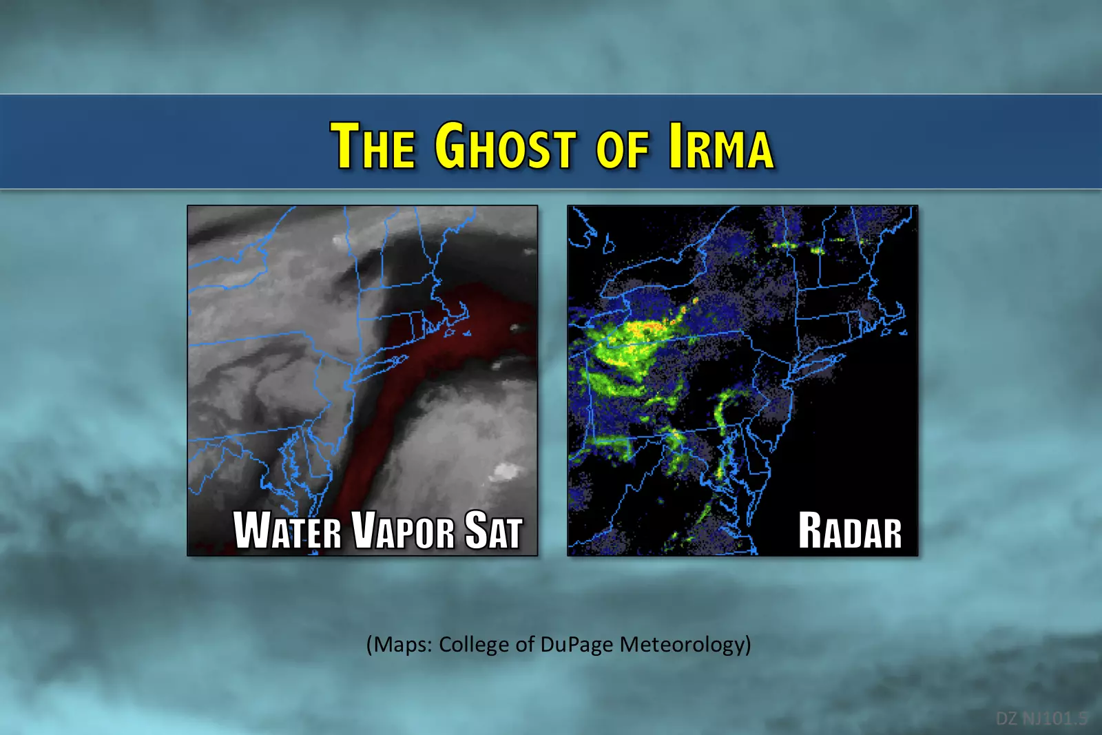
It seems like we've been talking about Irma forever at this point. (Well, a full two weeks, at least.) Finally, the storm has arrived, although it is but a scant whisper of its former strength.
On this Thursday morning, you may have noticed that our atmosphere has moistened up considerably over the past day. In other words, it's the return of humidity. That will affect Thursday's weather in several ways:
1.) Muggy. You will certainly feel the mugginess in the air this morning. Not oppressive, just noticeable.
2.) Temps. Moist air cannot cool down as much as dry air. So it's a pretty mild morning, with statewide temps mostly in the upper 60s.
3.) Fog. Pretty widespread, too. Visibility is down to 3/4-mile in spots. Not textbook-definition dense fog (that's 1/4-mile and below) but still pretty thick in spots. Watch your speed.
4.) Rain. Scattered showers and thunderstorms remain in the forecast for today. This humidity may help to enhance that rainfall, leading to a chance for periods of heavier, steadier rain.
Even though Thursday's storm system had tropical origins, I am not concerned about the flooding or severe weather potential. All week long, I've been calling rainfall totals insignificant, maybe a half-inch at the most. Yes, there could be rumbles of thunder and/or localized downpours, but that's about it. The day should not be a washout.
In addition to rainy and humid, we can also call Thursday afternoon breezy, cloudy, and fairly warm. High temperatures should peak in the upper 70s to lower 80s.
A lingering shower remains possible Thursday night, and we might see some fog develop overnight too. The fog depends on how calm the winds get, whether skies clear at all, and whether temperatures fall enough to meet the dew point (100% humidity).
Decent Weekend?
Most of the state will see weather improvements on Friday, and I suspect it will turn into a nice weather day with some nice breaks of sunshine. High temperatures should reach the lower 80s, with continuing high humidity. The only wrinkle for Friday will be a continuing chance for a shower or thunderstorm. Best chance for raindrops will be Friday afternoon, especially in the northern half to third of the state.
As Irma's remnants push out to sea, we set the scene for a nice weekend. Well, mostly nice weekend.
I just can't completely rule out a shower either Saturday or Sunday. The humidity stays with us, sustained by weak on-shore flow (winds from the east-southeast). Aside from the isolated shower chance, the forecast for the final weekend of Summer looks good — a mix of sun and clouds with highs in the lower to mid 80s for both Saturday and Sunday.
Hurricane Jose
New Jersey's weather for early next week will be highly dependent on the exact track, size, and strength of Hurricane Jose. As of this writing, Jose remains a minimal category one hurricane with 75 mph sustained winds. The storm is centered about 1,100 miles southeast of Cape May, N.J.
As we have discussed, Jose is completing a "loop de loop" maneuver in the middle of the Atlantic Ocean. The favored forecast track still turns Jose out to sea in the coming days, passing between Bermuda and the U.S. East Coast. Many of my meteorological colleagues have written off Jose as insignificant, claiming high confidence in the seaward forecast. I am not prepared to do that — the track is a little close to comfort. I just don't want to rule out very rough surf, coastal flooding, and possibly some rain and wind early next week. Let's discuss Jose's forecast again on Friday after a few more model runs.
More From New Jersey 101.5 FM


