
Rain arrives tonight, more wet weather this weekend
New Jersey should squeeze out one more pleasant, warm day on Thursday before showers and thunderstorms arrive Thursday night.
Here are your weather headlines for Thursday, June 25, 2015...
Squeezing Out One More Nice Day
Relatively low humidity made for a gorgeous weather day on Wednesday, and also has allowed temperatures across the Garden State to drop into the 50s this morning. That makes this our coolest, most refreshing morning in about two weeks!
The humidity level will stay low during the daytime hours today, as we manage one more pleasantly warm day before rain arrives tonight (see below). High temperatures will be around or just below yesterday, in the 80° to 85° range. Clouds will increase from mostly sunny this morning to partly sunny this afternoon, with a light southwest breeze up to 15 mph.
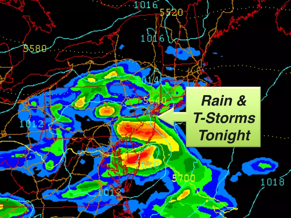
Rain Tonight
An isolated shower will be possible as early as about 5 p.m. today, and more substantial rain will arrive late this evening (probably around 9 or 10 p.m.) through the overnight. A few pockets of heavier rain and rumbles of thunder will be possible, particularly for the southern half of the state. (Although, just to be clear, these storms will be nothing nearly as strong or dangerous as Tuesday's severe weather.) Rainfall totals of a half-inch to an inch are expected tonight.
As showers taper off on Friday, the clouds and somewhat unsettled weather should remain. A few showers are possible throughout the day, as clouds keep temperatures cool. Highs will only be in the mid to upper 70s on Friday, about 5 or 10 degrees below normal for late June. We could see hints of dry skies and sunshine on Friday, but clouds really do look to win the day overall.
Rain This Weekend
Sorry, summer weekend lovers... Confidence is growing toward an extended period of steady and potentially heavy rain for New Jersey this weekend. Saturday will feature abundant cloud cover, keeping temperatures cool with highs only in the lower 70,s at best. Meanwhile, models have consistently shown a pretty well organized storm system arriving at some point on Saturday, with solid rainfall. There is a bit of disagreement surrounding timing of the rain at this time. The NAM says the steadiest rain will occur from about 8am Saturday through 8am Sunday, while the GFS pushes the raindrops a little later, from about Noon Saturday through 10am Sunday.
In either case, this means Saturday afternoon, evening, and overnight look pretty wet. Rainfall totals above an inch will be possible here. Limited heat and sunshine (which fuel instability, or energy) will significantly limit our severe weather chances. However, there could certainly be some embedded lightning and thunder within the rain.
The anticipated timing means we'll also (hopefully) salvage a decent day for Sunday. After showers end in the morning, skies should clear a bit to partly sunny. Despite a stiff breeze (up to 20 mph), high temperatures look to recover nicely to about 80 degrees.
More From New Jersey 101.5 FM


