

More rain, strong storms expected Wednesday across New Jersey
A fairly strong system will affect the Garden State Wednesday, with the potential for heavy rain, gusty winds, and frequent lightning.
Here are your weather headlines for Wednesday, February 24, 2016...
UPDATE, WEDNESDAY AFTERNOON: TORNADO WATCH issued for Atlantic, Burlington, Camden, Cape May, Cumberland, Gloucester, Mercer and Salem counties until 11 p.m. for heavy rain showers, scattered wind gusts up to 55 MPH and quarter sized hail. More details.
Another Damp Day
Across New Jersey, Tuesday was a pretty wet day. Rainfall totals were overall unimpressive - generally between 0.25" and 0.75". But roads were soaked and the air was damp all day long. In the higher elevations of North Jersey, some snow and sleet fell and accumulated in some parts of Sussex County.
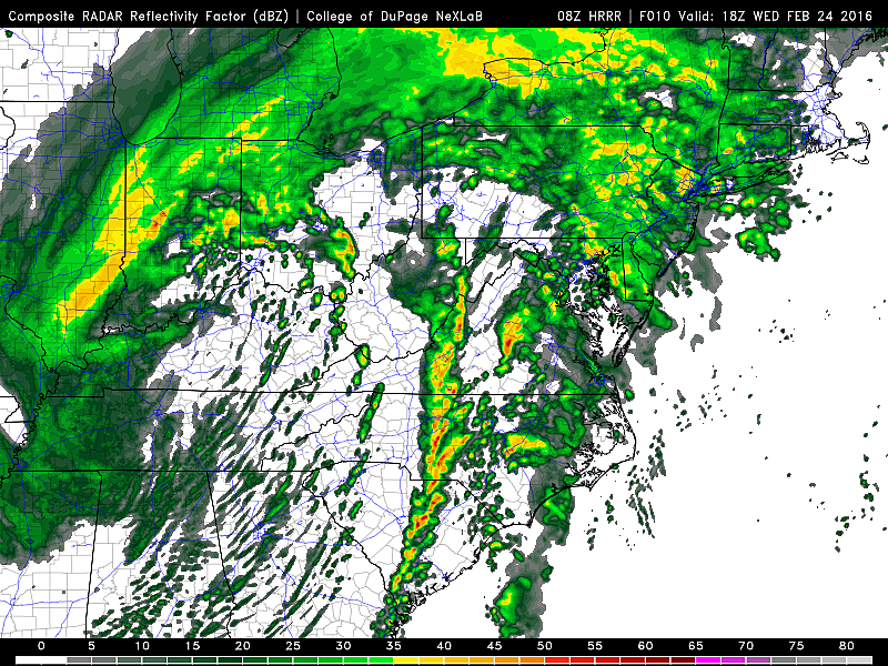
A second, stronger storm system will affect New Jersey on Wednesday. A blast of warmer air will shoot high temperatures into the lower 60s for part of the state. The warmup also means that, by mid-morning, anything that falls from the sky will be rain (rather than anything wintry).
During the daytime hours, rainfall intensity will range from hardly anything to moderate. Visibility may be reduced at times, both due to rain and patches of dense fog. Overall, it looks like another wet, sloppy day.
Strong Storms?
One final push of precipitation is expected to come Wednesday evening, and it looks to bring the heaviest rain of the week.
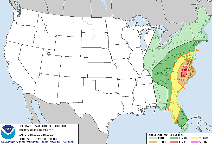
Temperatures will be very warm, moisture will be plentiful, and this storm system will have plenty of energy ("oomph") behind it. Given those parameters, it is certainly possible that we see some strong to severe thunderstorms Wednesday evening. Pockets of very heavy rainfall, potentially damaging winds, and frequent cloud-to-ground lightning will be possible. It's probably a good idea to plan to stay home this evening, if you can. At least plan to monitor changing weather conditions carefully before you attempt to travel anywhere.
General timing for this line of storms will be between 5 p.m. and Midnight. The best chance for the heaviest rain and strongest storms will be in the southern third of New Jersey.
Cooling Down
Through the early morning hours of Thursday, the rain will move away and weather conditions in New Jersey will gradually improve. We may hang on to some lingering showers throughout the day on Thursday - mostly rain, possibly some snowflakes (especially late in the day).
Meanwhile, temperatures will begin cooling down dramatically. While thermometers will read mid 50s on Thursday morning, they will fall into the 30s by Thursday evening. That's a big difference, and will certainly be noticeable - especially with the continuing brisk wind, up to about 25 mph.
Skies will clear away to sunshine for Friday and Saturday. But our weather will be a bit cool and blustery, with highs only near 40 degrees. (Normal highs for late February are in the mid 40s.)
The chill won't last long this time around, however. Temperatures bump back into the 50s for Sunday and Monday.
More From New Jersey 101.5 FM


