

A ‘big’ midweek storm? Probably just rain for NJ
The internet weather hype artists predicting a massive snowstorm are going to get this one wrong, as we have a mostly wet week ahead for the Garden State.
I promised you an update on a potentially significant storm system that could impact New Jersey by midweek. It's actually a pretty easy update, as the forecast is clearly pointing toward a wet instead of a wintry solution for New Jersey.
Last Wednesday, I first made mention of a potential storm in the February 22-24 time frame. I made it clear that a week is far too early to give such detail on a storm system, and declared it as a storm "worth watching". Meanwhile, some meteorologists and social media-rologists took the low road of hyping this potential storm with dramatic graphics depicting snow, ice, doom, and gloom for the Northeast. This storm is a perfect example of the limits of weather forecasting (especially in the winter). There are some times when we just don't know and/or can't say what's going to happen.
I fully admit that last week, the long-range forecast was looking very interesting and somewhat alarming, with a low pressure tracking right along the east coast. If the system made a wiggle to the east, New Jersey would end up on the cold side and it would turn into a very snowy forecast. A wiggle to the west, and we would see mostly rain.
When I talk to schools and community groups about weather, one of the most popular questions I am asked by weather enthusiasts is "What is your preferred forecast model?" The answer: I don't have one. As you know if you read my blogs often, I make use the "big three" models on a daily basis to assist my forecasting: the GFS, the NAM, and the European. Each model has its own strengths and weaknesses, but I look at all three every single day. What I'm looking for is consistency among those three models: If they all give the same (or a similar) forecast, that gives me confidence that we know what's going to happen.
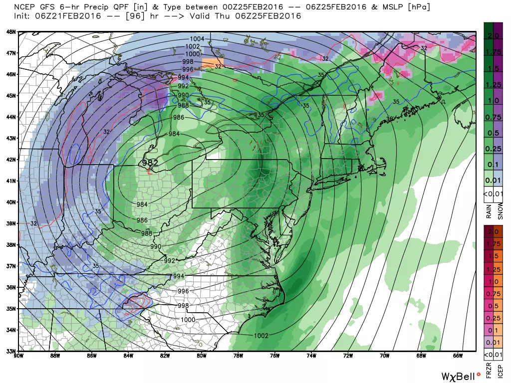
All three models are now in agreement. A wiggle to the west. Mostly rain for New Jersey. Instead of the low tracking over New Jersey, the latest models show it way out over Ohio. The timing has also moved a little later since we initially thought, with peak rainfall expected early Thursday morning.
Having said that, we could still see some wintry weather from this system, especially in North Jersey and especially on the front (early Wednesday) and back (late Thursday into Friday) of the system. But we're talking about an inch or two of snow, not almost a foot.
As always, we'll continue to keep you updated on the forecast as it continues to evolve this week. Until then, go enjoy Sunday's 50+ degree temperatures!
Dan Zarrow is the Chief Meteorologist for Townsquare Media New Jersey. Follow him on Facebook or Twitter for the latest forecast and realtime weather updates.
More From New Jersey 101.5 FM


